
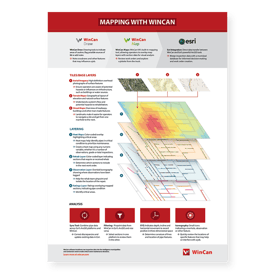
WinCan’s new downloadable quick guide, Mapping With WinCan, is a valuable resource for operators and engineers alike. With helpful descriptions and examples of tiling, layering and analysis tools, this guide introduces users to WinCan’s array of mapping features and workflows.
WinCan VX provides 3 unique avenues for mapping, each with a variety of tiles, or base layers, to start with. From there, users can layer maps with inspection data to gain insight into maintenance trends, such as rehabilitation plans, inspection history and pipe rating. Most importantly, these features are powered and supported by Esri’s ArcGIS, allowing users to integrate WinCan VX with Esri platforms as well as a variety of asset management tools for broader analysis of infrastructure. WinCan map analysis tools allow for bidirectional transfer of data as well as support for 3D modeling, making it easier for municipal teams to gather and analyze the data they need for maintenance decision-making.
This free, full-color downloadable poster is a guide for both beginner WinCan users just learning the ropes as well as veterans who simply need a reminder of WinCan’s mapping features. It functions as a quick reference ideal for office or field work, supporting inspection workflows from work order creation to analysis.
Download your free copy of WinCan’s Quick Guide: Mapping With WinCan today: