
-1.jpeg)
Serving more than 80,000 people in Goleta Valley, California, the Goleta Sanitary District is on a mission to promote public health and environmental safety. The District has made major investments in a long-range capital improvement plan that seeks to consolidate data formats and conduct essential replacement and rehab projects over ten years. The plan uses detailed criteria to correct structural and hydraulic defects for nearly 7,000 underground assets, minimizing risk of infrastructure failure throughout the collection system.
.webp)
Integrating software for utilities is just one way the City of Raleigh, North Carolina, is prioritizing routine infrastructure inspections and maintenance activities. The stormwater division alone oversees 35,500 storm drains and 609 miles of pipes and culverts across the city, working to monitor and protect waterways and residential areas. As demand for maintenance increases, connected, cloud-driven technology helps the city effectively manage their assets.
Good data is ready for analysis when you are. Sewers are essential infrastructure, and prompt, actionable inspection results help keep our communities safe, healthy and clean. In today’s world, that means seamless, bidirectional data transfer that keeps databases updated in real time, with results rippling throughout the system to enable data-driven maintenance decisions.
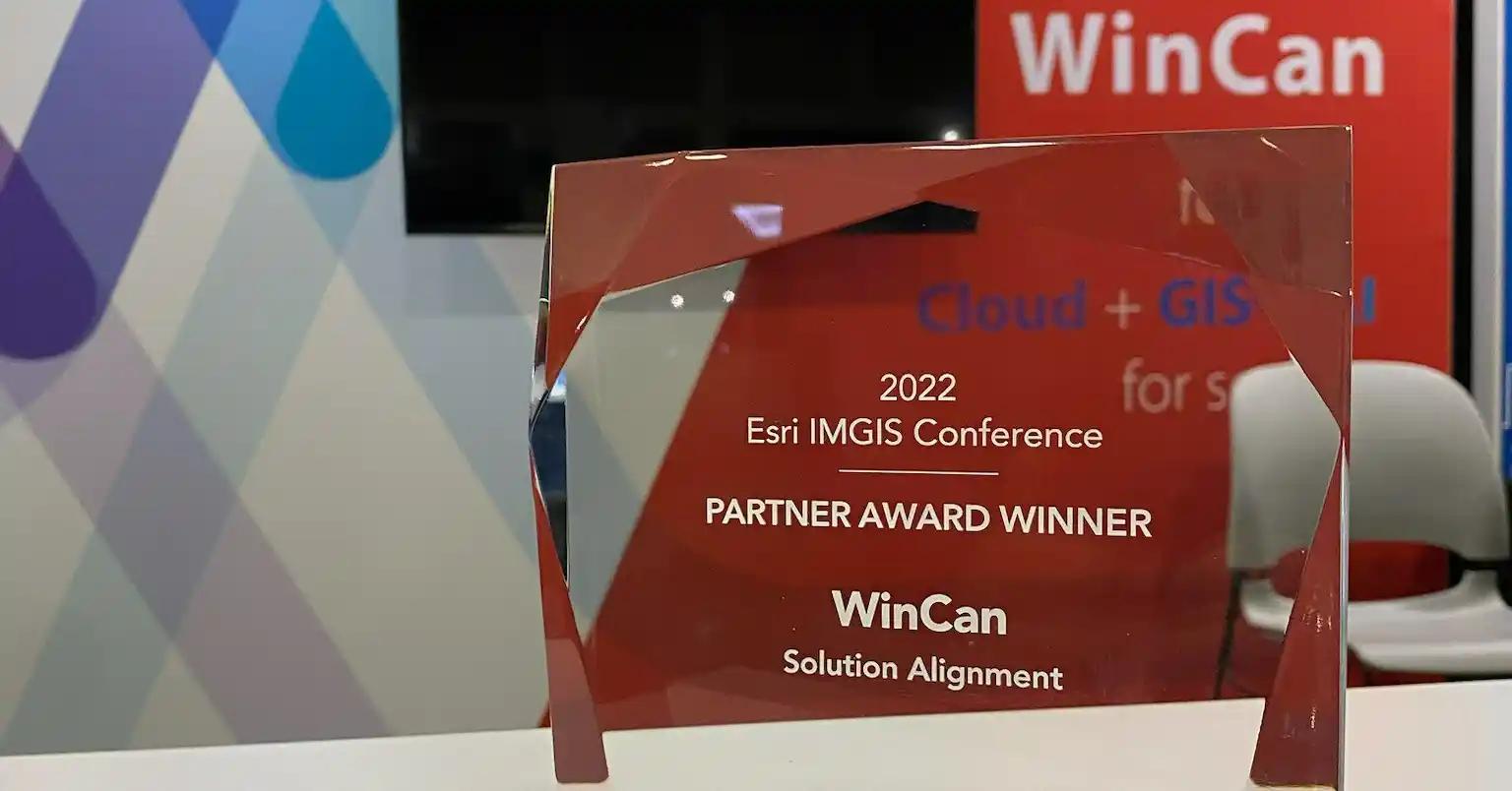
WinCan recently received the Solution Alignment Award at the 2022 Esri Infrastructure Management and GIS (IMGIS) Conference held in Palm Springs, California. The award was presented to WinCan for demonstrating innovative and creative ways to solve complex problems with Esri’s ArcGIS software.
In July 2022, WinCan was officially recognized as a part of the ArcGIS System Ready Specialty, a designation for Esri partners that consistently adopt and integrate new ArcGIS software releases into their solutions, services, or content. In many ways, this signifies the next stage in our relationship with Esri as software partners, and reinforces our continued promise of providing the industry with efficient sewer inspection solutions that support GIS workflows for both field and office users.
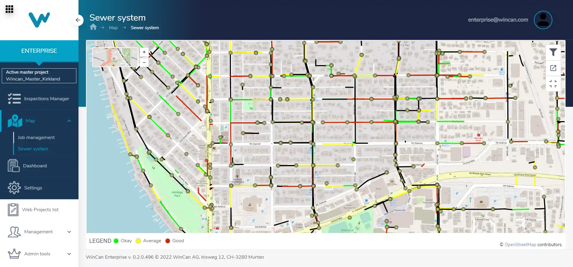
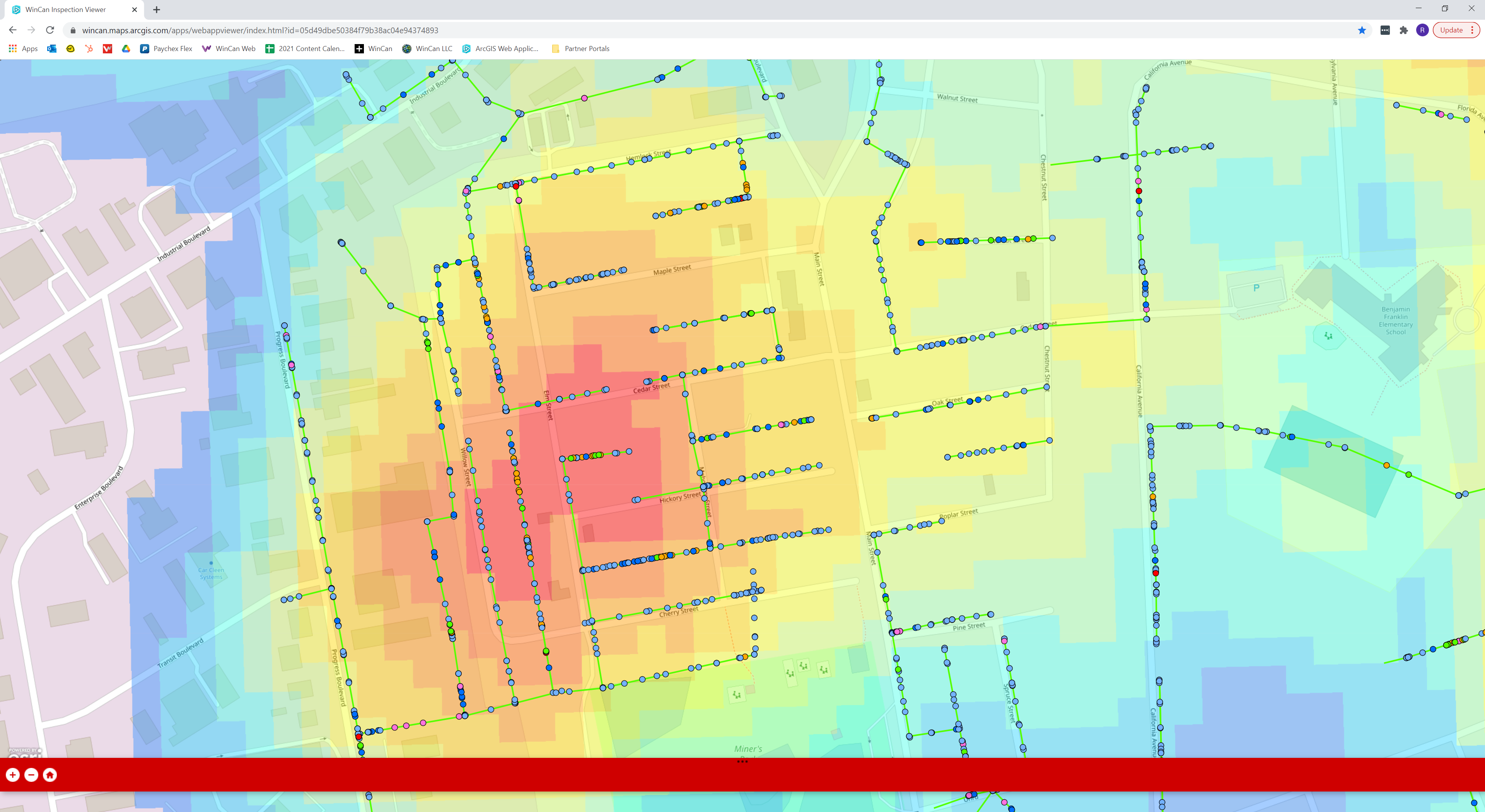
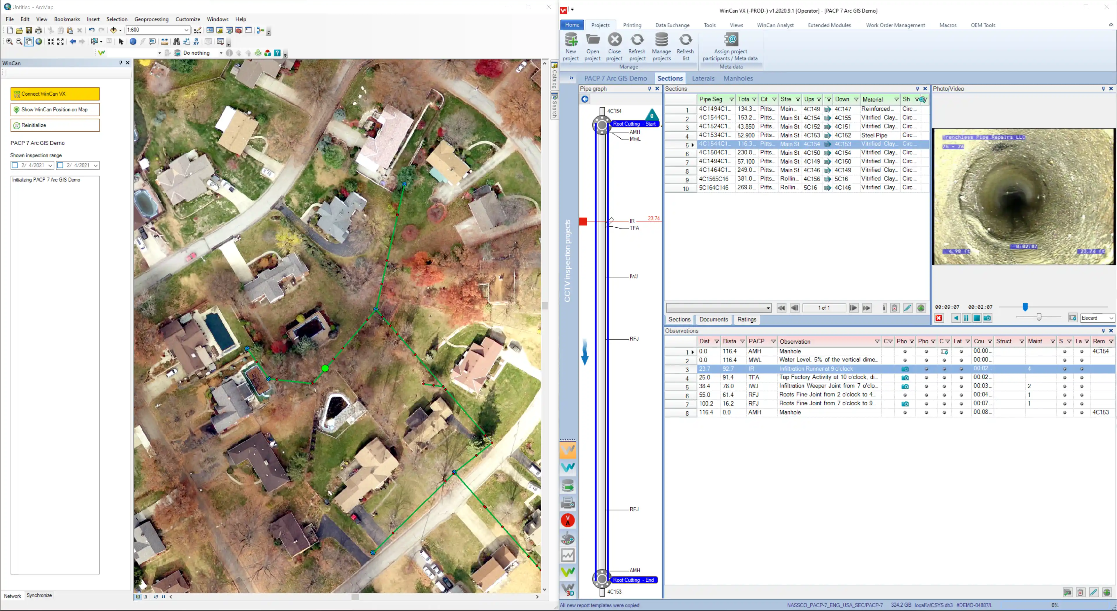
Having complete, accessible mapping data is integral to job site coordination, and it’s often required in the broader analysis of sewer system health. Over the years, WinCan has expanded its mapping features intentionally, ensuring sewer teams are able to navigate their systems with accurate, up-to-date data and visualization. As technology evolves, it’s vital that these mapping capabilities are accessible in the cloud, compiling data from various sources to paint a more vivid picture of what work is getting done where, and the implications of inspection results.
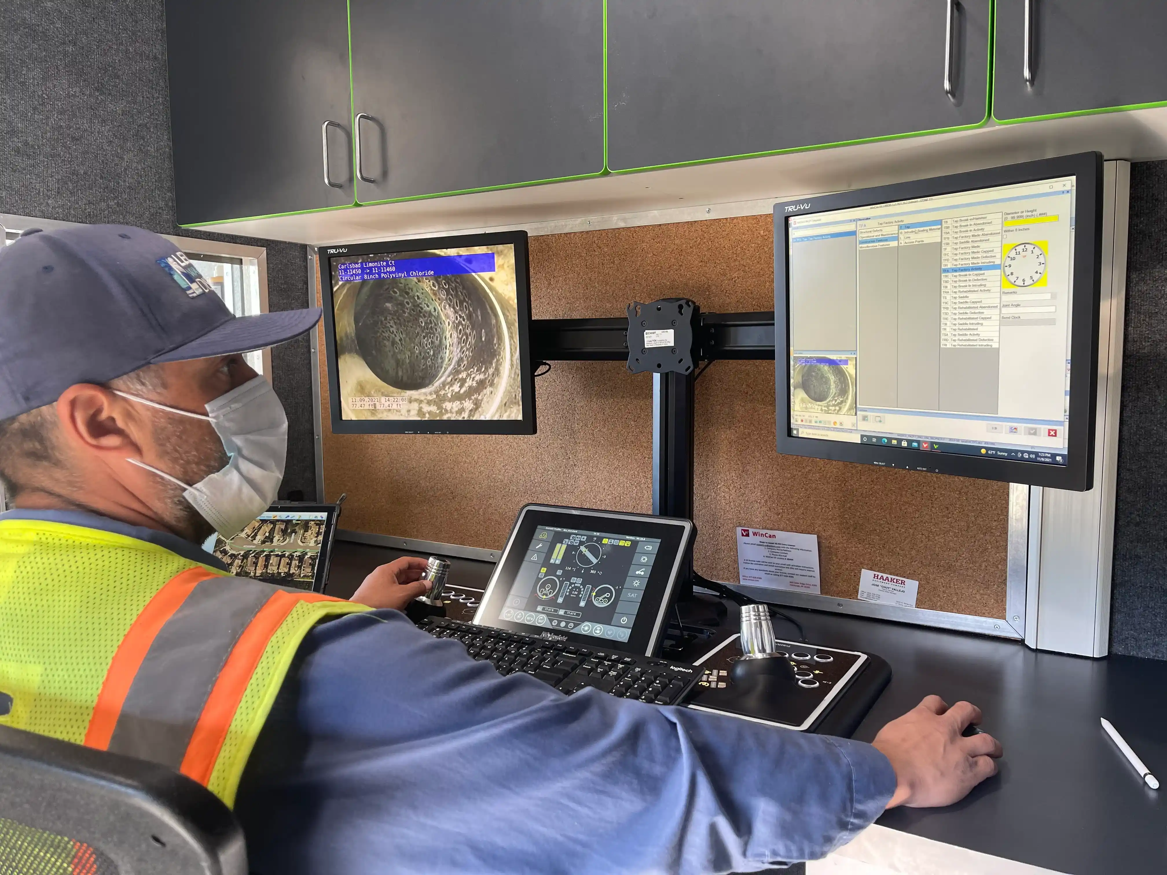
GIS queries allow sewer inspection teams to quickly review specific data and better understand the location and condition of a pipe section or sewer system. They are user-initiated requests to translate data points into actionable information.

Located at the confluence of three watersheds and surrounded by two salmon-bearing rivers, Springfield, Oregon, promotes good wastewater practices. The city has an initiative that addresses the fact that fats, oils, and grease (FOG) have no place in the sewers. This is one of many efforts the city has in place to keep its wastewater system clean and operating smoothly. With the help of WinCan VX integrated with Esri's ArcGIS Online, the city is enhancing efforts to ensure that main lines are healthy and wastewater is flowing properly.
With 225 miles of wastewater lines, varying from 6" to 60" in diameter, Springfield's wastewater inspection team needs technical solutions that encompass both maintenance and mapping. Chris Zeitner, Springfield's geographic information system (GIS) database administrator, says WinCan and Esri technologies have the integrated functionality needed to automate workflows between inspection and analysis, and to streamline the decision-support process.

Geospatial Information Systems (GIS) are computer systems that collect, store, manage and analyze data relevant to precise locations on Earth. They are the backbone of humankind’s most powerful mapping solutions, and they allow us to gather accurate information about the location of infrastructure in real-time.
Most real estate agents will tell you laterals can cause problems for home and business owners, such as blockages, wear-and-tear and leaks. But they can also cause trouble for construction and rehab teams if they are left undocumented and unmapped, and they are often major sources of systemwide I&I. For this reason, some municipalities shoulder the burden of inspecting residential sewer laterals, while others leave it to residents to request lateral inspection.
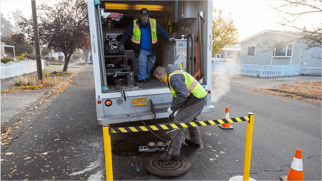
To be successful in these efforts, inspection teams need the right equipment and technology to traverse lateral lines and record inspection data about their location and condition. Without complete and accurate documentation, both property owners and rehab teams could be at risk. In the digital age, more municipalities are turning to Geographic Information System (GIS) mapping as a solution for easily accessible lateral information and historical data. And with an effective digital workflow to map out laterals, inspection teams can add wastewater laterals to their regional records, store lateral pipe data in a digital map, and ultimately make that map and data remotely available to engineers and city officials.


