Utilizing inspection data to manage a wastewater system is a big task. With so many system assets (pipes, manholes, laterals) and so many factors that influence their performance, the amount of data collected can overwhelm even the most experienced manager. WinCan helps you correlate data to real world factors in order to distill insights, develop practical maintenance strategies and maximize your budget. The applications are numerous, and evolving mapping technologies promise to expand on them in the future.
 Correlate Defects
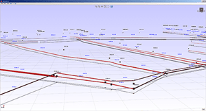
With wastewater infrastructure inspection, it can be easy to overlook the relationship between underground assets and surface features. WinCan’s mapping tools let you overlay your collection system with satellite maps to identify links between, for example, large trees and frequent root problems, lateral connections and sinkholes, or ponding surface water and prevalent I/I. WinCan's 3D features allow you to view a virtual model of underground pipe based on inspection parameters like diameter, branch angle and inclination data, which can be useful for seeing problems like sags and offsets.
Establish Criticality
Understanding the proximity of sewer assets to waterways, major thoroughfares and other vital infrastructure can help you more accurately prioritize and plan for their repair. Know if a line runs under a highway or railroad tracks. Understand where redundancy is built into your system and where it isn't. Calculate how extensive the upstream consequences of a specific asset failure would be. Properly plan for traffic control when scheduling rehab work.
Plan for Wet Weather
WinCan interfaces with applications that can help you prepare for wet weather events. Before wet weather hits, WinCan's mapping tools help you understand which emergency infrastructure is at greatest risk during floods and high water. Overlay elevation data with critical infrastructure and stormwater collection system data to determine which areas will flood first. Then, make repairs to those areas of your collection system during dry weather so you're ready for rain or snow melt.
See the Big Picture
Planning sewer rehab means prioritizing your needs and optimizing your resources. Visualization tools built into WinCan help you plan your approach. Use WinCan heat maps to reveal where problems are clustered by type and severity, so you can minimize travel and setup time for your crew during scheduled repairs, or operate more efficiently when contracting out sewer rehab work.
If your team is drowning in data, let WinCan be your life raft. Request a free web demo to see the difference WinCan VX software can make in your workflow.