
Wastewater systems are vital to ensuring the health of our communities. Yet they are constantly at risk — from both everyday wear and tear and catastrophic natural disasters — so departments must ensure their systems are resilient and sustainable.
Utilizing inspection data to manage a wastewater system is a big task. With so many system assets (pipes, manholes, laterals) and so many factors that influence their performance, the amount of data collected can overwhelm even the most experienced manager. WinCan helps you correlate data to real world factors in order to distill insights, develop practical maintenance strategies and maximize your budget. The applications are numerous, and evolving mapping technologies promise to expand on them in the future.
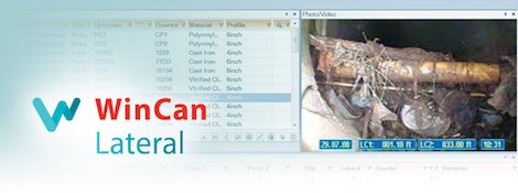
Sewer maintenance professionals depend heavily on sewer inspection equipment and software. In simple terms, the equipment gathers video and measurements from inside the sewer, and the software allows us to classify, analyze and archive that data. With the latest generation of software yielding new insights and better maintenance decisions, choosing a software platform is as important as choosing equipment. However, software often comes bundled into a crawler sale, so purchasers may fail to understand their full range of options. Ultimately, many settle for what’s presented, rather than what’s possible.
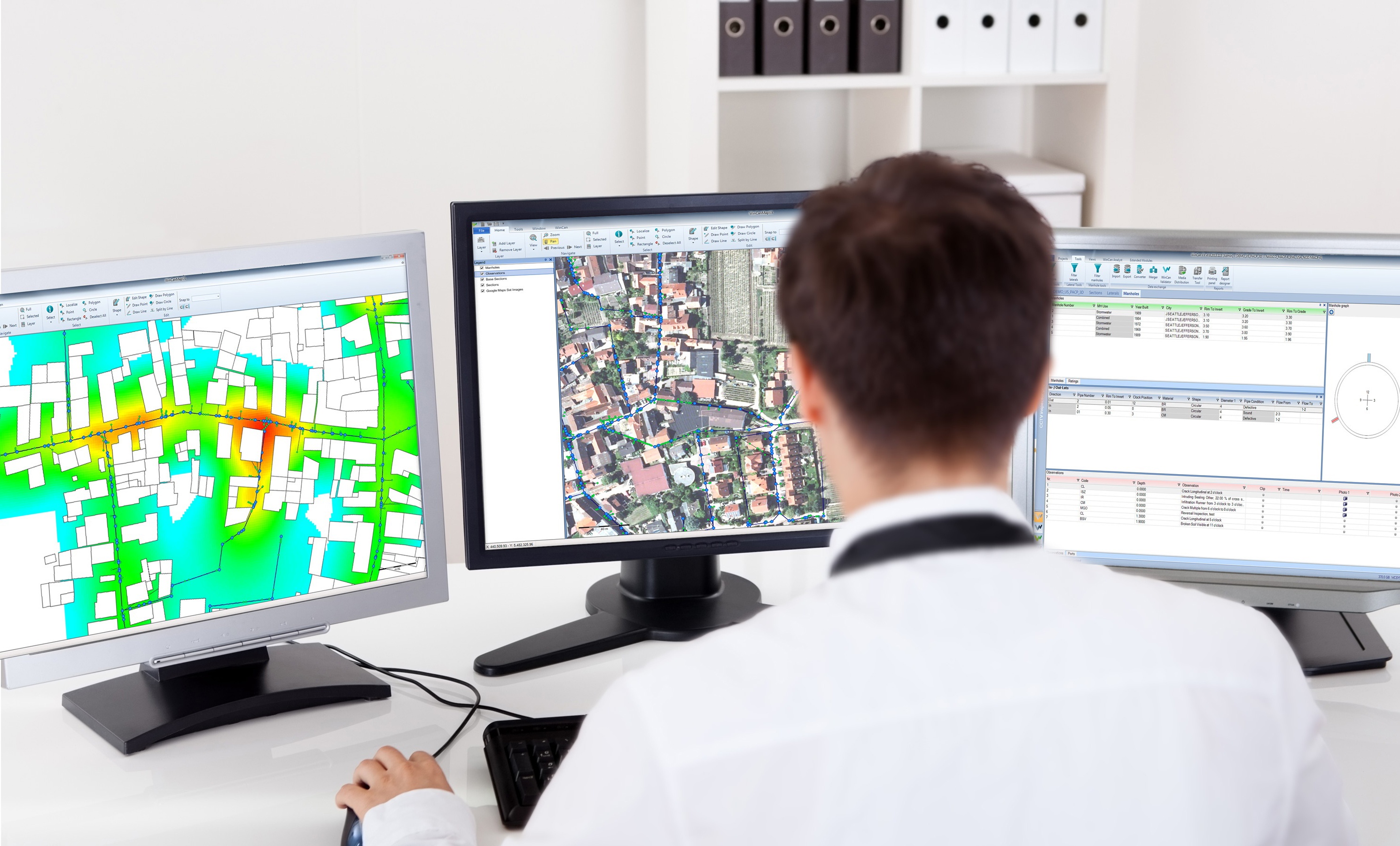
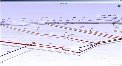
When integrated with Esri’s ArcGIS platform, WinCan VX sewer assessment software allows users to navigate and analyze inspection data using a rich GIS (geographic information system) interface. With it, users can click map features to link to section and defect information, or they can click a tabular record in an inspection to jump immediately to its mapped location. With this bidirectional link between GIS and WinCan, inspections can be pre-populated with data residing in GIS (eliminating manual data entry) and GIS data can be updated with results once an inspection is complete. Beyond simply mapping data, the ArcGIS integration allows users to filter results, create reports, browse media and build heat maps according to defect type or severity. It also assists with workflow by allowing you to select regions, assign them to specific inspection crews and then monitor per-crew progress graphically with color-coded indication.
As cloud-based storage becomes more popular, municipalities, utilities and contractors must consider the benefits cloud-based solutions provide, particularly for sewer inspection data management.
A cross bore occurs when one underground utility line intersects another. Cross bores are particularly dangerous when a gas line intersects a sewer line. This happens during horizontal directional drilling (HDD), a technique for installing a gas line using a remotely piloted drill head. During HDD, installers must rely on city asset maps to avoid existing sewer pipes. Erroneous or incomplete map data can create the potential for a cross bore. When a cross bore occurs, the intersecting gas line can snag debris in sewer effluent, causing a clog. If that clog is forcibly cleared, the gas line may rupture and leak into adjoining buildings, where it presents a serious potential for explosion.
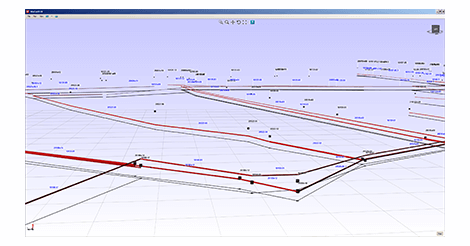
Not only is precise mapping of a municipality’s underground assets important for maintenance and inspection purposes, it can help avoid cross-bores from directional drilling. The challenge is that municipalities can’t count on as-built plans for accurate mapping of underground assets. In the past, municipalities have relied on locators or on digging up pipes to get a visual. Both of these solutions can prove inefficient and sometimes inaccurate. Increasingly, municipalities are deploying geospatial probes, special sensors that are capable of tracking their position in 3D space using a technology called inertial navigation. The data provided by these sensors can be read by WinCan’s 3DGS Scan module to create in real-time a virtual 3D computer model of underground assets.


