
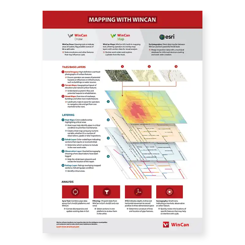
WinCan’s new downloadable quick guide, Mapping With WinCan, is a valuable resource for operators and engineers alike. With helpful descriptions and examples of tiling, layering and analysis tools, this guide introduces users to WinCan’s array of mapping features and workflows.
More than ever before, municipalities are working to build digital models of their sewer networks that reveal the intricacies of both form and function. GIS mapping software has become an essential tool in this endeavor, and for many sewer professionals, Esri’s ArcGIS stands out as the pinnacle of geographic information systems.

Sewer inspection workflows vary from one municipality to the next. They are often built around the structure of the inspection team, but equipment, budget and the size of a sewer system all play an important role in determining what workflow makes the most sense for a given community. With so many different inspection, asset management and mapping solutions on the market today, there is no end to the possibilities. Take a look at the workflows below to get an idea of how WinCan workflows compare to more traditional, manual workflows.
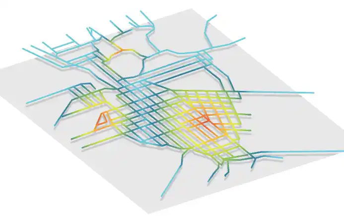
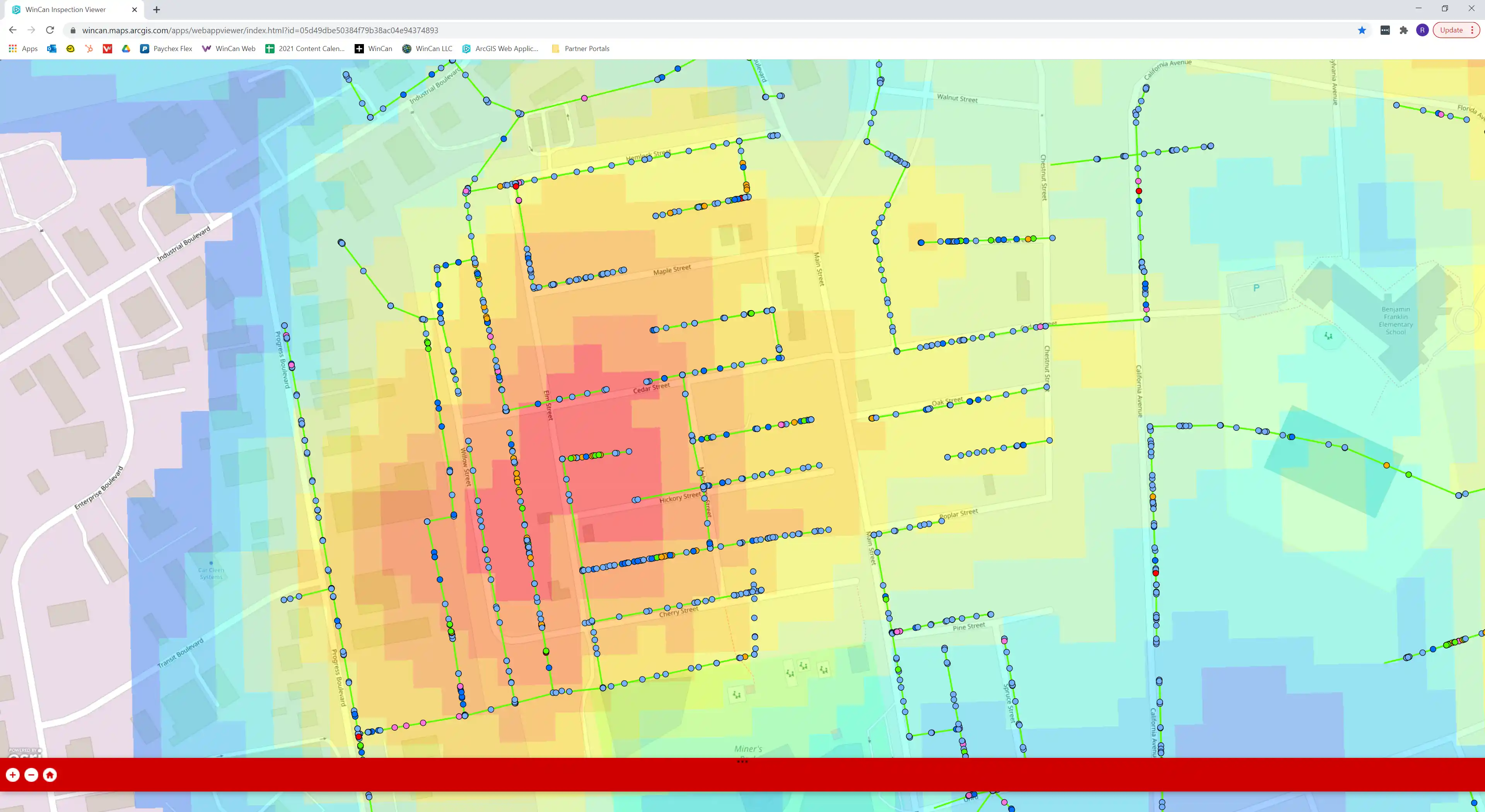
Data takes on new meaning when it’s laid out on a map. Heat maps, iconography and geographical features all help build a clearer picture. The human brain naturally processes images differently than it does letters and numbers, allowing us to gain a unique understanding of data sets and how they interact with each other. In the world of wastewater management, mapping data can make it easier to understand where a sewer system is located, as well as potential risks to the community and infrastructure.
Having the capability to visualize data is a crucial part of any wastewater team’s inspection workflow, and WinCan’s flexible GIS integrations makes it easier than ever to do so.
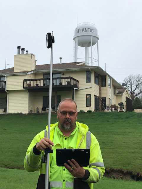
Atlantic, Iowa’s vibrant, historic downtown and community traditions keep the past close, but that hasn’t stopped it from
modernizing and updating its utility operations.

Every wastewater system is unique: Age, geography, pipe materials, rehab methods, and climate all shape infrastructure over time. But even in the diverse landscape of American utilities, some systems stand out.


Cities are constantly pressured to find new ways to cut expenses while maintaining a high quality of service for ratepayers. Shifts in federal and state funding — in combination with aging, degraded sewer systems — make this task even more difficult. In many cases, municipalities end up working equipment for longer and fall into a pattern of reactive maintenance and delaying major repairs. But there are serious consequences to putting off the inevitable. Crises, by nature, are unexpected emergencies, but that doesn’t mean municipalities can’t plan for them and prepare their collection systems for events like natural disasters.

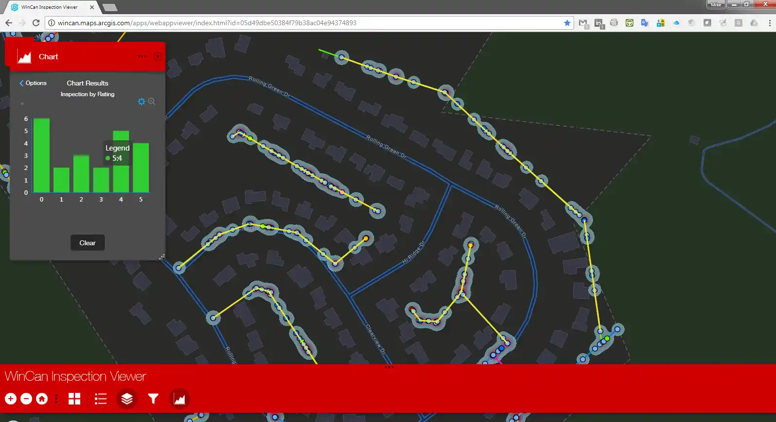
When integrated with Esri’s ArcGIS platform, WinCan VX sewer assessment software allows users to navigate and analyze inspection data using a rich GIS (geographic information system) interface. With it, users can click map features to link to section and defect information, or they can click a tabular record in an inspection to jump immediately to its mapped location. With this bidirectional link between GIS and WinCan, inspections can be pre-populated with data residing in GIS (eliminating manual data entry) and GIS data can be updated with results once an inspection is complete. Beyond simply mapping data, the ArcGIS integration allows users to filter results, create reports, browse media and build heat maps according to defect type or severity. It also assists with workflow by allowing you to select regions, assign them to specific inspection crews and then monitor per-crew progress graphically with color-coded indication.


