
More than ever before, municipalities are working to build digital models of their sewer networks that reveal the intricacies of both form and function. GIS mapping software has become an essential tool in this endeavor, and for many sewer professionals, Esri’s ArcGIS stands out as the pinnacle of geographic information systems.

Sewer inspection workflows vary from one municipality to the next. They are often built around the structure of the inspection team, but equipment, budget and the size of a sewer system all play an important role in determining what workflow makes the most sense for a given community. With so many different inspection, asset management and mapping solutions on the market today, there is no end to the possibilities. Take a look at the workflows below to get an idea of how WinCan workflows compare to more traditional, manual workflows.
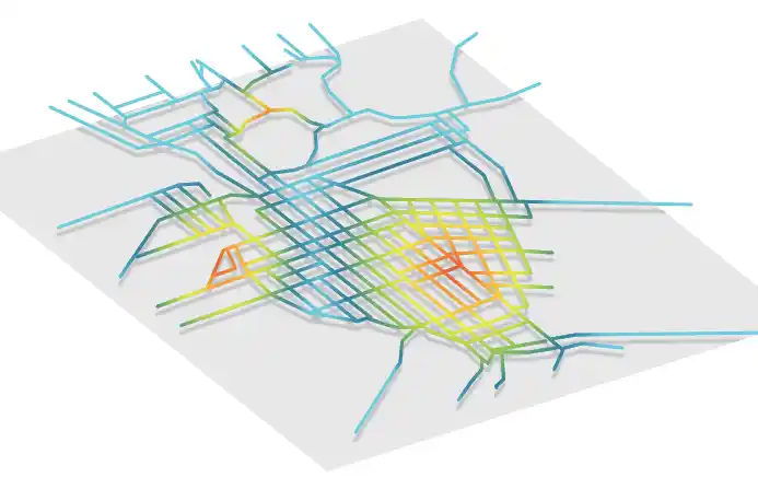
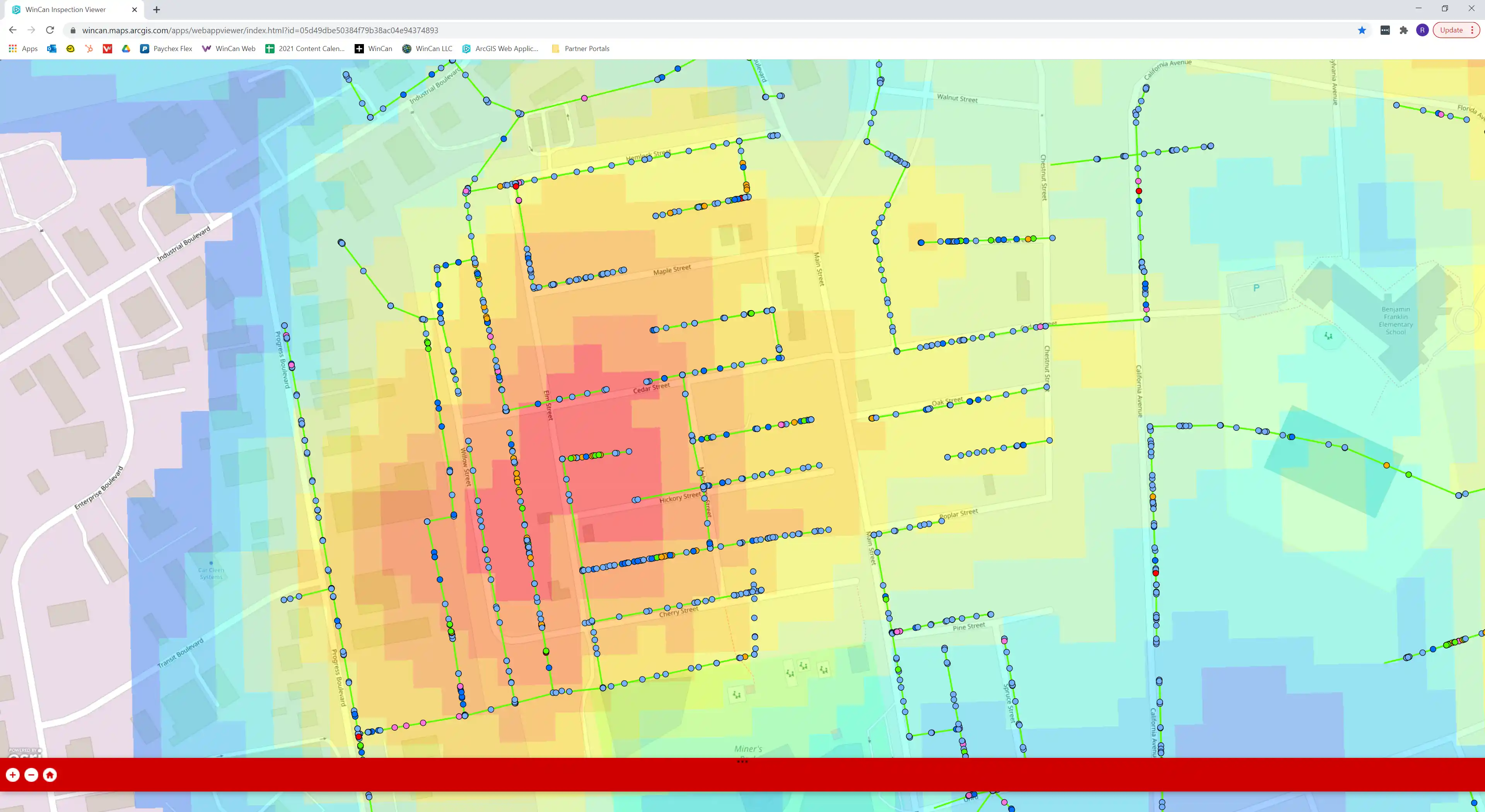
Data takes on new meaning when it’s laid out on a map. Heat maps, iconography and geographical features all help build a clearer picture. The human brain naturally processes images differently than it does letters and numbers, allowing us to gain a unique understanding of data sets and how they interact with each other. In the world of wastewater management, mapping data can make it easier to understand where a sewer system is located, as well as potential risks to the community and infrastructure.
.webp)
Municipalities often have hundreds of thousands of assets to keep track of. Without an accurate record of each one, its location and its condition, it’s impossible for engineers and operators to properly plan maintenance and expansion. However, advances in inspection and analysis methods are changing the way we understand the infrastructure that is under our feet, giving us the ability to visualize collection system layout and capacity like never before.
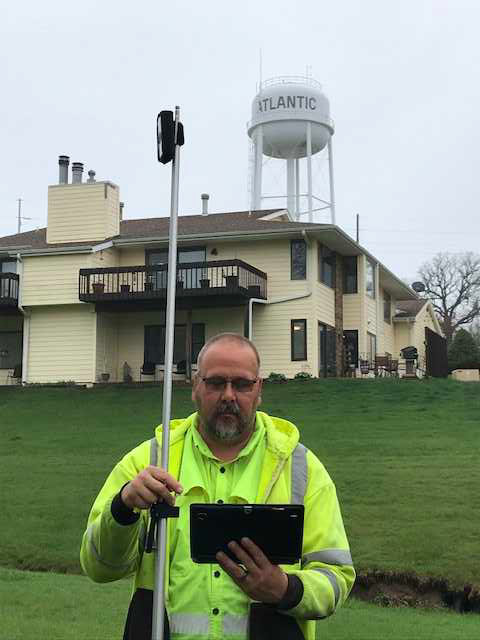
Atlantic, Iowa’s vibrant, historic downtown and community traditions keep the past close, but that hasn’t stopped it from
modernizing and updating its utility operations.
Utilizing inspection data to manage a wastewater system is a big task. With so many system assets (pipes, manholes, laterals) and so many factors that influence their performance, the amount of data collected can overwhelm even the most experienced manager. WinCan helps you correlate data to real world factors in order to distill insights, develop practical maintenance strategies and maximize your budget. The applications are numerous, and evolving mapping technologies promise to expand on them in the future.
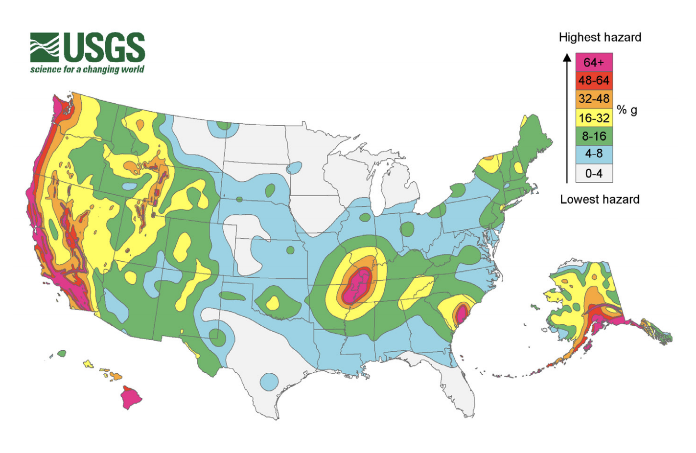
Water and wastewater systems are a vital aspect of our daily lives, and any upset to these systems can have a ripple effect that impacts entire communities. That’s why it’s essential for water utility companies in earthquake zones to understand the threat these disasters pose to their systems and adequately prepare for emergency situations. To minimize damage and decrease recovery time, municipalities need to take an active role in earthquake preparation.


Cities are constantly pressured to find new ways to cut expenses while maintaining a high quality of service for ratepayers. Shifts in federal and state funding — in combination with aging, degraded sewer systems — make this task even more difficult. In many cases, municipalities end up working equipment for longer and fall into a pattern of reactive maintenance and delaying major repairs. But there are serious consequences to putting off the inevitable. Crises, by nature, are unexpected emergencies, but that doesn’t mean municipalities can’t plan for them and prepare their collection systems for events like natural disasters.

It may be hard to imagine how augmented and virtual reality (AR/VR) reach beyond video games and high tech. Yet these technologies, known together as mixed reality (MR), are more accessible than one might think. Mainstream audiences got to experience them every day at Disneyland for fifteen years on Soarin’ Over California. The ride, which debuted in 2001, immersed guests in an MR aerial adventure. In addition to video and audio, flourishes of AR brought the experience to life: Small fans cast a gentle breeze across riders, and an orange-scented mist wafted through the air as they passed over video orange fields. And while the simulated experience didn’t quite capture the real life one, when families stepped off the ride, many felt as if they had truly flown across the state.


